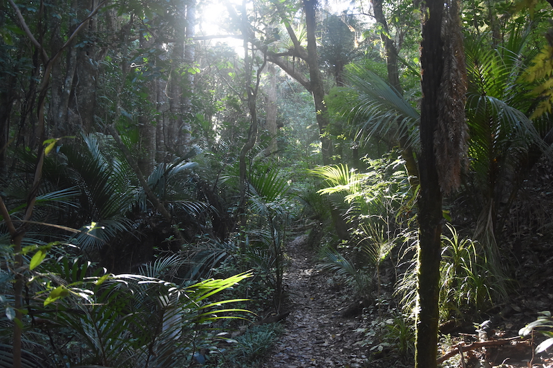
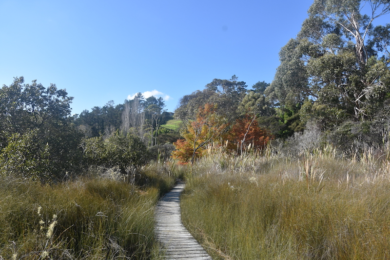
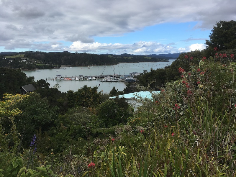
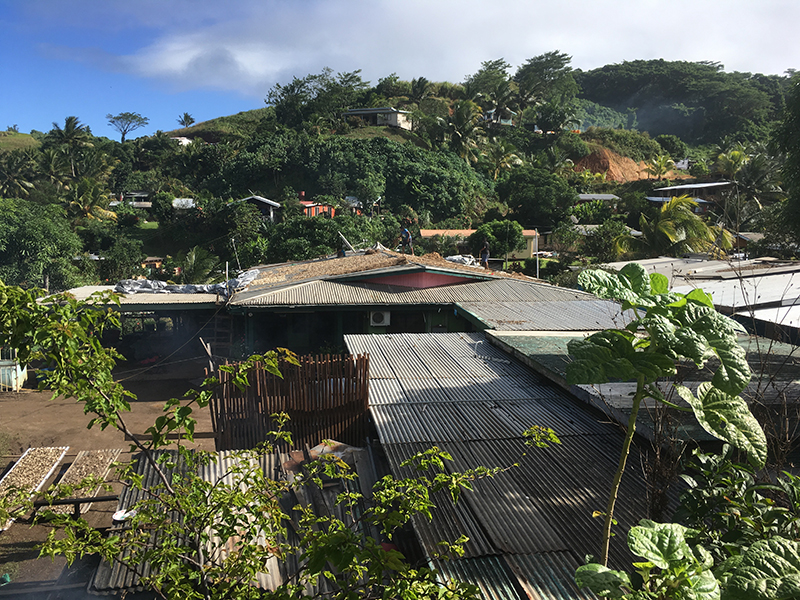
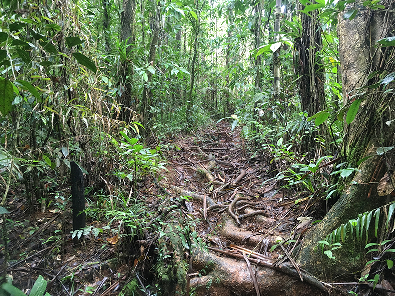
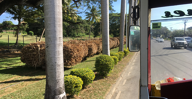
Round Walk -Opua, Russell, Pahia
Whilst waiting for a good weather wind to leave for for Fiji I took the opportunity for a little walk. I took the vehicle ferry from Opua to Okiata, walked though the bush and by bays to Russell (3 and half hours). Took the passenger ferry to Pahia then the coastal track back to Opua (2 hours) A nice little leg stretch with some good views.


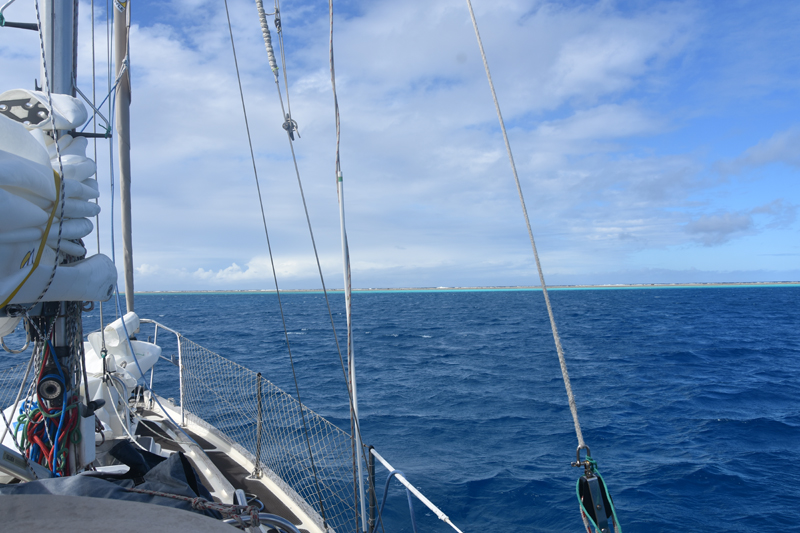
Passage to Fiji
All ready to go it was a matter of waiting for a good weather window for the passage to Fiji.
Following the passage of a front with a bit of a blow, the forecast looked good. Time to go and indeed apart from a windless departure when I had to motor for 8 hours we had good winds.

At some some stage with our rate of progress I reckoned we would arrive in Fiji on a Fri eve or Sat morning. With the Fijian authorities charging overtime, minimum 3 hours at weekends at 100F$ per hour, a weekend arrival is to be avoided.
Anchored at Minerva reef
So although I had not planned to stop over at Minerva reef I now did thinking to stay just 2 nights. However I arrived with one of those squeezes between a tropical depression to the north and a high to the south. The wind soon picked up and didn’t slacken below 24 knots for 5 days. Anchoring here in these conditions was anything but restful. After 4 days I was fed up of the situation and headed out, leaving later risked another weekend arrival.
I did wonder the wisdom of my decision with 27 knot winds and gusting higher and rough short seas, but Vancouvers are such good sea boats, 3 reefs in the main and staysail she just ploughed on.
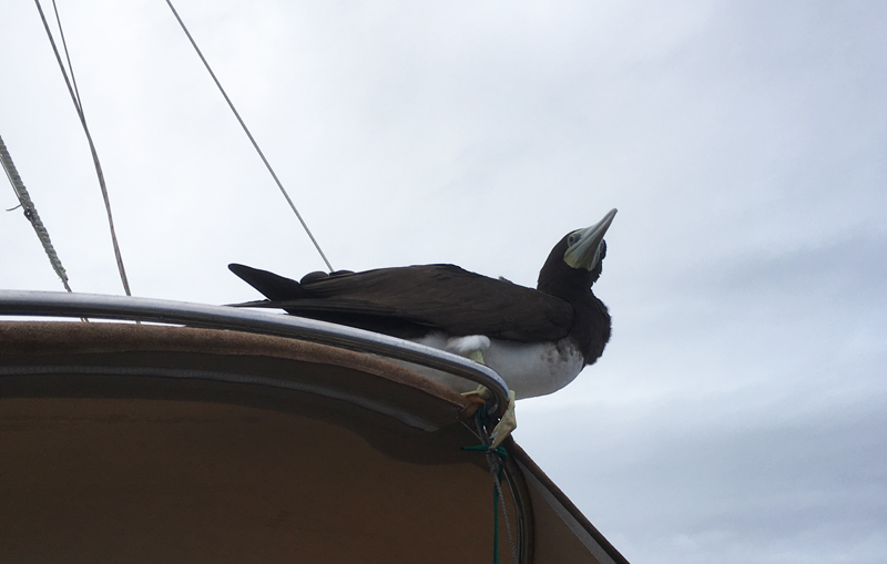
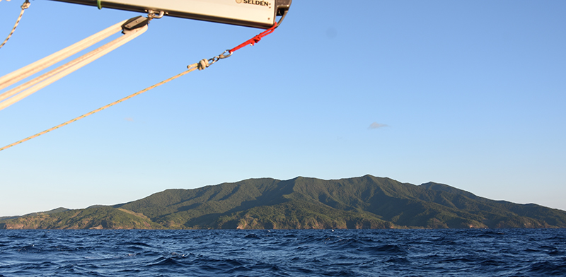
Booby aboard
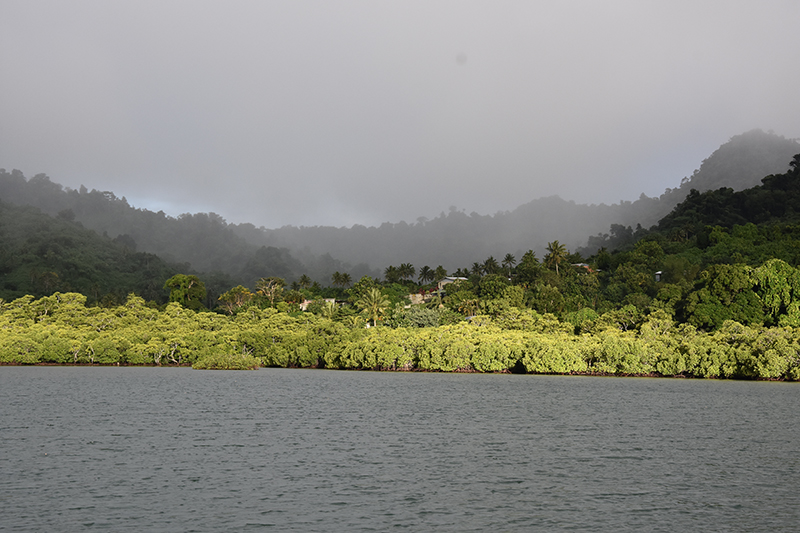
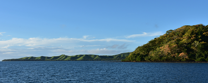
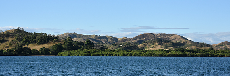
Dawn of the 15th day since leaving Opua revealed the island of Matuku, the first of the Fiji group. I would have liked to stop here but you must check in at a recognised port of entry so had to keep going.

Matuku Island Fiji
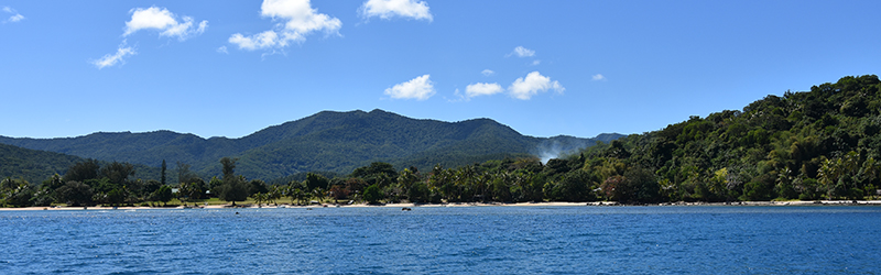
Closing with my destination and it seemed likely that I would arrive on a Thursday eve just after dark. Not liking this idea I decided to slow down so as to arrive at first light Friday. Down to just a staysail though I was still going too fast, around 4 knots. Ironic how sometimes you struggle to achieve that speed with all sails set! Still once past Koro island with a decent amount of sea room all around I hove to for few hours. Letting draw later I arrived with good light to spot the pillar marking the reef of the point, rounding this, another few miles in the bay to arrive at Savusavu,
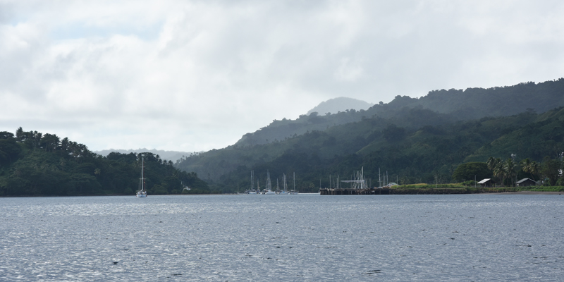
Approaching Savusavu
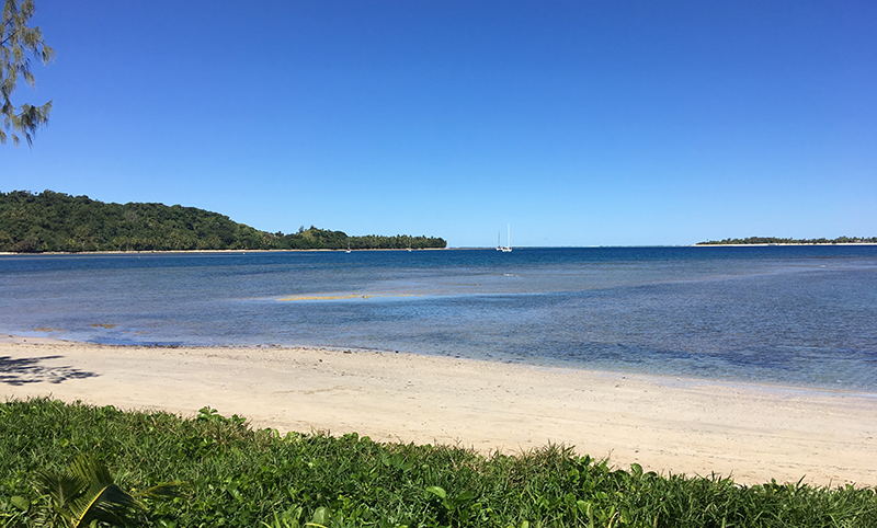
I picked up a mooring buoy at 09.30, perfect for normal working hours for the authorities.
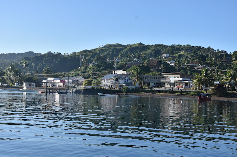
Savusavu
Checking in was quick and painless, here they come out to your boat, Health pratique, Biosecurity, Customs and Immigration. Given permission to land it was time to find an ATM, pay the relevant fees and then the reward of a cold beer.
Passage of 1257 miles
Savusavu days
It was good to recover and relax after the passage and do a little exploring around.
I walked out along the coast to the end, Passage point, visiting on the way the Flora Tropical gardens. I wandered around the timber walkways amongst many endangered palms, a tranquil and beautiful place.

Mangroves near Passage point
I also took a bus ride to Labasa, this took me along the coast, up into the mountains and the rainforest then down through pine forests and through vast areas of sugar cane.

Bus trip to Labasa
Labasa is a very Indian town with shops full of saris and curry houses. The Indians originally arrived as indentured labourers for the sugar plantations. Now it is reckoned they make up some 40% of Fijis population and their influence is plain to see.
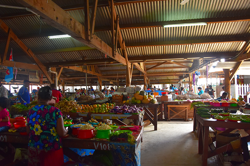
Labasa market
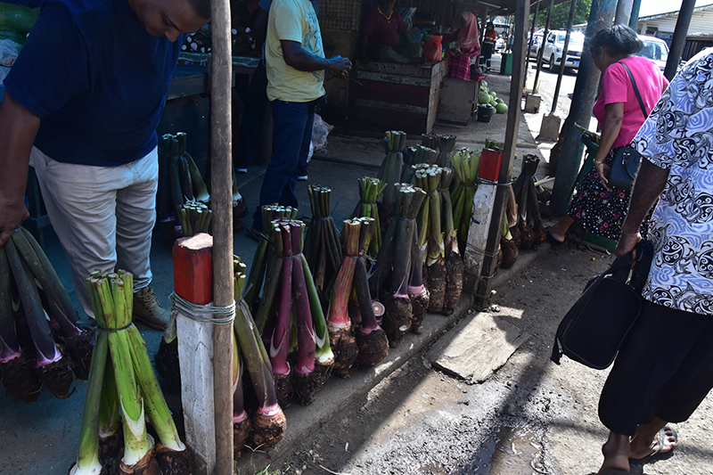
Taro
There is a good market in Labasa, I always delight to wander around markets see all the goods on offer and I bought some kava so that I may make sevusevu when I visit outlying villages.
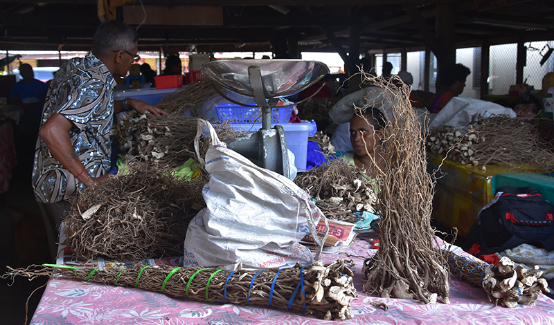
Kava

Buying Kava
I had a nice curry for lunch then later caught the bus back. This bus ride was great way to see other parts of the island.
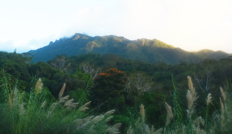
Fiji mountains
Another day I took the bus out to the Copra pressing plant where they extract coconut oil from the copra. Unfortunately they weren’t pressing oil that day so I could not see the whole process. Had a long hot walk back.

Coconut plants

Extracting copra
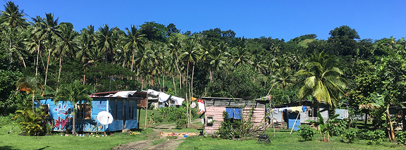
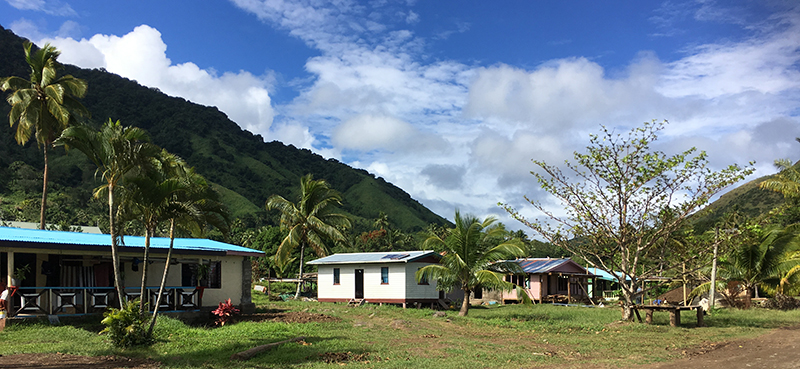
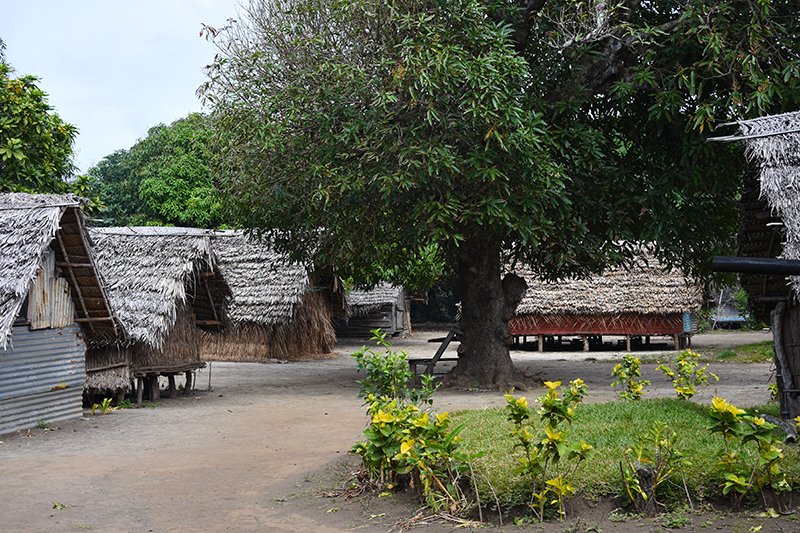
Fiji village
Meanwhile my friends Jan & Richard had arrived from New Zealand in Morpheus. They had had a rough and worrying passage and trouble with their engine so they arrived under tow.
The weather has been unsettled with lots of dark clouds and rain and strong winds so I am waiting for an improvement before heading off anywhere else. Because of all the extensive and largely unmarked reefs in Fiji, navigation is a bit of a challenge and you need good light and visibility so you can see the reefs underwater.
Kava drying on roof
Another walk took me over the hill behind the town and down to the south coast. The tide was out so the sea a long way from the beach over the reef, but I love these wanders looking at the house and villages.
Tavenui – Qamea – Nairai – Gau – Ovalua: 9th-22nd July
At first I was the only yacht anchored off Vacaia Bay, Taveuni, but later more yachts joined me there including a family I had met in Katherine bay. They had caught a Mai mai that morning and like me and unusual these days had no fridge so they gave me some generous sized fillets. Good eating this. It was a beautiful spot here. I walked to the supermarket past the airstrip at the tip of the island for bread and stopped for a beer on the way back sitting on a lovely veranda overlooking the bay.

Vacaia bay
Ilil who I had briefly meet in NZ and then bumped into again, joined me for a couple of days as I said I would give her a lift to Qamea. Had a good sail around the north of Taveuni but just as we were about to go through the reefs to Qamea the cloud mist and rain came down. Fortunately it only lasted a little while. According to the charts the reefs were supposed to be marked with beacons but they were missing, probably wiped out by one of the cyclones. Anyway safely through we proceeded until we could safely turn into Naviivi bay. The reefs halfway in are at least marked and we could anchor beyond them. Two guys in a boat came out to talk to us, went away then returned shortly with a note from his Mum who was an Auntie of someone on Taveuni that Ilil had got to know. We were invited to visit so putting on my sulu and grabbing a bundle of kava we were ferried ashore in the school boat, made sevusevu with the headman of the village and then went to visit Angela and family.
There are no roads on this island and the children go to school by boat.
Naviivi Bay
Next day on the way for a walk towards another village we past a group of 7th day adventists who had just finished their morning service. They invited us to lunch with them and would brook no refusal. So we sat down in the shade of their church cum shelter crosslegged around some big straw matts with vast bowls of Fijian fare. Resuming our walk was up a steep narrow overgrown and very muddy track, plenty of slipping and sliding. I turned and and returned at the top of the hill.

Naviivi bay from on high
Ilil left to stay at another village and I set off for the long trip to the island of Nairai. The winds were light and sometimes non-existent for this 90 mile passage so it took me over 30 hours .
I anchored off the village of Tuvo Lailai in Green Mound bay. Next day I went ashore to make my sevusevu with the headman. This the main village on the island was very small and there are no roads or vehicles on the island at all. They live by farming and fishing.
Green mound bay, Nairai
The day turned out rather miserable, completely overcast sky high winds and rain and kept that way all night and into the next morning. The anchor had dragged a little in the night so I wasn’t happy at this anchorage. Late morning the weather looked to be clearing a little so I took the opportunity to weigh anchor exit the reef and head over the the nearby island of Gau where after entering the reef at the middle passage I anchored in Heralds bay.
Herald bay, Gau
This might be some version of paradise, crystal clear waters yellow coral sand beaches, coconut palms and a steep hillside behind. I saw turtles and you didn’t need to snorkel to see the brightly coloured fish and soft corals – just row to the beach.
Coconut point, Gau from Herald bay
No-one lives in this bay though they visit it to fish or gather coconuts. The village of Sawayake lies in the next bay around the corner. Next morning I found the track that led there through the forest. Once again dressed in my sulu I made sevusevu with the headman and was welcomed to the village. The headman had lived in England a while, at Catterick camp when he was with the Royal Signal Corps.
Sawayake village Gau
Wandering about I was invited in for tea and many people wanted to talk to me. Walking back I was thrilled to see my first Fiji parrot close up, brilliant red and green. Back on the beach with the dinghy was a man and two of his sons. We sat and chatted and they gave me green coconuts to drink, delicious and refreshing. Some women were fishing from their bamboo raft. It was a glorious day.
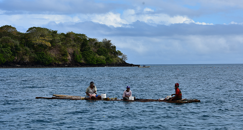
Fishing from bamboo raft
All change in the night, high winds and rain and from the S or SW so bringing some swell into the bay so the boat had swung through 180 degrees. It was unpleasant and slightly worrying. All next day overcast sky, wind and occasional rain.
Neither of these bad weather spells had showed up on the long range forecast, all these while it was supposed to be fine – so much for forecasts.
Next morning there was some breaks in the cloud and the wind had eased a little though still strong. I had had no bread for days and was right out of fresh vegetables being away from shops for so long and anyway it was time to head west so I weighed anchor and headed for Ovalua. I still had 20 -23 knots of wind at first and moderate to rough seas but with the wind on the beam, 2 reefs in the main , staysail and partly furled yankee Sea Bear made good speed. I thought the 30 mile passage might take 7 hours or more but within 6 we were in through the reef at Levuka and safely at anchor.
Levuka, Ovalau
To Rabi island and elsewhere
Eventually the forecast was looking better and I left Savusavu. First hop was just about 5 miles down the coast to anchor by the reef just past Costeaus resort.

Anchorage at Cousteus
It meant the saving of about an hour on the next day a day to round passage point and head east along the coast. It meant motoring most of the day but I did a couple of hours sailing in the middle of the day before the wind died. The entrance through the reef to Fawn harbour had a dog leg but visibility was good and safely inside I crossed the lagoon to anchor. A very peaceful tranquil place this, just the distant roar of surf on the reef. I stayed the next day having a peaceful but lonely birthday.

Fawn Harbour
Leaving through the tricky entrance then east again, a flat calm so more motoring. I headed for the reef entrance of Vivani then carried on around the SE tip of Vanu Levu and up to the narrow mangrove lined bay of Naqaiqai. The wind was back but anchoring in 6m the holding in mud was good and the water sheltered. Next day was blowing hard so I remained here.
Next place to visit was Bucca bay, passing Kioa island where they were out fishing from their outrigger canoes. It was calm when I got to Bucca but no sooner having dropped the hook the wind sprang up blowing from the NE. The bay is open to this direction so a chop soon built up. Nevertheless I did go ashore for a walk. I thought that since there was a wharf that a ferry went from served by a bus from Savusavu there might be a shop, I could do with fresh bread but there was none. I did get some pink bananas though and some nice ginger.
It wasn’t really on to stay overnight on account of the wind and chop so I ups anchor, retrace my track to Kioa island. Entering the bay by the village I thought better of anchoring here, I couldn’t find anywhere suitable shallower than 20 m and the bay wasn’t sheltered in the prevailing conditions. I nipped back across to Naqaiqai. I would have liked to visit Kioa, the inhabitants are from Tuvalu, 800 miles to the north, displayed to here when their own island was threatened by sea level rise from Global warming.

Somosomo
I crossed the Somosomo strait to anchor of Somosomo on the island of Taveuni. A couple of the world ARC boats were anchored here. The anchorage doesn’t have a lot to recommend it apart from giving easy access to the shops. I bought a new sim card for the phone, had a chicken curry and bought fresh vegetables and bread.
The weather forecast was for a trough to arrive bring strong winds rough seas and much rain. Time to seek some shelter, the best prospect seemed to be Katherine bay on Rabi island. I had a bit of a rough passage back across the strait, winds gusting to 27 knots and breaking seas. The fringing reef of Rabi is about 4 miles offshore, the passage in not marked so some tension. Once inside the reef I had hoped the reef would break the waves and calm the seas but the reef is not shallow enough so it was rough all the way in finding a careful way between the inner reefs. Once inside the bay although the wind was till strong the seas were much calmer and I anchored in 9 m much relieved to be in.
Rabi although part of Fiji is populated by Banaban Islanders from the Gilbert Islands (now Kiribati). Their island was made uninhabitable by the extraction of phosphate a tragic and heartbreaking story caused by corporate greed and British government connivance.
You are supposed to report to the Rabi police here so according I took the morning bus, a 4wheel drive truck with bench seats, to Nuku the capital. There is just the one road on Rabi, well a dirt track really that runs through the jungle and along the coast. Nuku is not much of a capital, a village with just a few official buildings. None of the official building were occupied but enquiries pointed me to the policeman’s house- it was the one with the police bike outside. One oh his sons raised him from a nap and I presented him my papers and he made a few notes in a note book. It hardly seemed worth the effort. It was now about 11 in the morning, the next truck back I was told was not until 3. There was nothing to do in Nuku, so I decided to set off walking.

Road on Rabi
It’s always a nice way to see more of a place. Past a few small villages where the kids always waved and the adults greeted me with Mauri, the traditional greeting. I was the only white face around. The people are different from Fijians much more like Indonesians I thought.
Drying palm fronds Rabi
I ended up walking all the way back, took me over 4 hours the last hour in heavy rain. Not one piece of traffic passed me in all that time. Passing by a house in the last hour as the rain came down I was called over to the veranda where gathered about 8 or 9 menfolk. A big bowl of grog (kava) was being passed around so I was pressed to partake, there is a fairly strict equiquette to this the cup is handed to you by the person on your left, you are supposed to drain the cup in one whereupon everyone gives 3 soft cupped hand claps. The elder here said he must sing for me so he sang and performed a meke dance partly in English partly in Kiribarti. He said there must be 3 songs and 3 bowls of grog. It was entertaining and enjoyable. Then I resumed my trudge back in the rain to the dinghy and so to the boat. Back aboard I stripped off in the cockpit so as not to take the wetness into the cabin.
The bad weather had certainly arrived but the anchorage was snug and secure.

Katherines bay
Some days later I moved around to Albert cove towards the north of the island. Getting in here was a double reef entry, first an outer reef then an inner reef to gain entry to the cove itself. All reefs unmarked of course, I was glad the light was good enabling you to spot the shallow water, even so it is a bit nerve wracking.
The cove was a lovely spot, yellow sand beaches backed by coconut palms. Only a couple of people live here to harvest the copra, there is no road or track access, just by boat.
Albert Cove

Net fishing Albert Cove
After a while here I decide to go back to Somosomo, I was long out of bread and fresh veg. Good light is needed to get out of the cove so an early start is ruled out, the sun needs to be well up in the sky to see the reefs clearly. It limits your sailing time to say between 8.30/9.00 am until 4 pm
I didn’t have enough time to make it in one hop so stopped again in Katherine bay.

Katherine bay looking towards Taveuni
Back in Somosomo I was disappointed – there was no bread. Apparently no flour on the island because the ferry to the island from Suva had stopped running. I didn’t get the full story whether this is temporary or full time.
The anchorage at Somosomo is I find too rolly for comfort so I moved about 6 miles to the north of the island. Matai was recommended in through the reefs with flat water but the light was poor when I arrived and I didn’t like the look of it so went back half a mile to another anchorage off a beach.
Levuka & Suva 23rd – 31st July
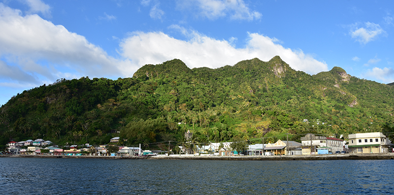
Levuka was situated in a beautiful setting, a backing of a high amphitheatre of jungle covered hillside with rocky peaks. It was the original capital of Fiji and was were the secession to England was signed. The capital was transferred to Suva later when limits of space made themselves felt here.
Nowadays it feels like a slightly down at heel township although the Tuna cannery seems to be doing well, there is slight smell of canned fish permeating the town. It was a bit strange to be back in a place with roads, cars shops and resteraunts after my time on the islands.
I walked south down the coast to the place of secession marked by a bronze plaque and the original treaty house, now looking sadly neglected with vast patches of the thatched roof missing. Inland I climbed up the 199 steps of mission hill and carried on up the valley to a small waterfall where the towns water supply comes from. There were nice views over the town from here and many little shacks where everything had to be carried up by back.
Levuka – view from mission hill steps

Sea Bear at anchor at Levuka
After a few days I decided to make the trip to Suva. It was too far to go in daylight hours so late afternoon saw me weigh anchor and sail out through the reef entrance for an overnight passage. The wind was very variable mainly S/SE so to go S meant a lot of tacking. One tack to stand out eastwards from the coast and then a long tack S/SW almost going in the desired direction, gradually closing the coast until a mile away from the reefs then tacking out again. It was a wearisome business but eventually the lie off the coast turned around the corner so to speak and I could lay the desired course. Gradually I could go from hard on the wind to a beam reach then a broad reach and finally a run as I rounded the reefs off the SE corner of the mainland.
Eventually I came into line with the leading marks for passing the reefs to enter Suva harbour and could gybe to sail in. As befits a major harbour used by big ships, the beacons marking the reef edges and the leading marks were good, Once in I made my way across and anchored off the Royal Suva yacht Club by early afternoon. Only 75 miles but it had taken me 22 hours.

Sunset at Suva
Next day I walked into town. Suva is big and bustling and there are a number of department stores where apart from the cliental you could think yourself back in the UK, such a stark contrast to the islands. I shopped at the excellent fruit and veg market, had a nice curry for lunch and caught the bus back to the RSYC.
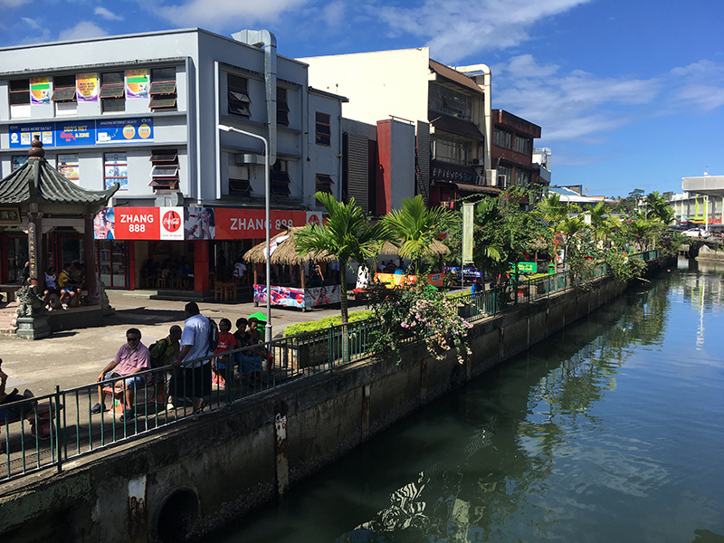
Chinese quarter Suva
We had another trough come through when I was anchored here, high winds, plenty of rain and a choppy sea which confined me to the boat for 24 hours.
Another day in town saw a visit to the botanical gardens, which I found a little disapointing.

Misty day Suva
Much better next day I took a bus out to Colo-i-Suva rainforest reserve. Had a nice walk around here, there were some nice waterfalls and pools including one with a tarzan type rope swing.

pool in rainforest

Rope swing
The path I took out was steep ‘rooty’ and muddy. Heard lots of birds but they are very hard to spot amongst all the trees.
Rain Forest track
After several days I felt it time to leave the harbour is busy full of ships, many rustbuckets and wrecks and the water is dirty and polluted. I weighed anchor and headed out one morning, next stop 100 miles along the coral coast.

Suva harbour
Vuda point
It was fairly cloudy when I weighed anchor in Suva harbour but i hoped it would clear later. Approaching the leading marks for the passage for the reef I had a bit of a scare when a big tug that had been on station headed straight for me. I turned the boat around and he altered course to still point at me. Transpired that he just wanted to warm me there was big tanker heading in to the channel and please pass starboard to starboard. I suppose he had tried to reach me on the radio but mine was off, I reason that I can’t be below to respond to the radio and on deck steering and looking out at the same time! The channel through the reef is pretty wide so there was no problems passing the inbound tanker. Once out I could set the yankee, the main was already hoisted and set a course for the start of the Beqa channel about 20 miles away. It was grey and drizzly but the sea was pretty calm and fairly gentle wind of 10 – 14 knots from astern wafted us along. Gradually the weather cleared and the afternoon turned out fine. The narrowest point of the channel between the mainland and the reefs of Beqa is about 1 mile wide, there was a marker on the reefs of the mainland but none on the outlying rocks of the islands. It’s a case of trusting the plotter plus of course careful eyeball navigation. Once through I could shape a course to give me a good offshore clearance before evening. The Coral Coast has a bad reputation for yachts and I wasn’t about to flirt with it too closely at night. I kept a careful eye on a boat far ahead but heading my way. Judging it would cross my bows I was ready to alter course when it was obvious that the Chinese fishing boat was just going to plough ahead seemingly regardless. In the end it passed about 200m ahead of me, I didn’t see anyone in the wheelhouse and no-one on deck and no AIS signal. All rather worrying for the passage at night. With dusk I put my customary precautionary reef in the main and settled down for a long night. Later an increase in the wind called for a 2nd reef in the main so i was glad i already had the 1st in. I saw the lights of a couple of ships one bound west the other east but they were well clear of me.
Just before the dawn I spied the light on the SW corner of the mainland. It was light when I rounded it and gybed to head for my waypoint at the start of the Navula passage. The wind was increasing, now 25 knots and the seas quite nasty so in with a third reef and now just a scrap of the yankee. I was a little concerned about passing through the reefs in these conditions but the entrance is wide and well marked with two massive beacons. As I drew near, now with the boat close hauled, I sailed into the lee of the reefs which calmed the seas considerably and I was pleased I could hold the correct course. Once through I continued on the same line to arrive in Momi bay. It was still blowing strongly but I anchored at 10.20 am in about 8m in the shelter of the bay. 26 hours for the 96 mile passage. Time for cuppa then a short nap.
Momi bay
I stayed here the rest of the afternoon and the next day whilst the wind still blew strongly.
My friends Jan & Richard on Morpheus were in Vuda marina so I made my way there, mostly motoring as no wind. The entrance is a channel cut through the reef, it doesn’t look its supposed 25m wide at low water and with the depth showing as 2m at it’s shallowist I entered with due caution. The marina is in the form of a circle with boats Med moor style bows pointing to the wall, stern lines attached to buoys. The staff help you moor thank goodness. To disembark means climbing over the pulpit to step onto a wooden platform, how hard or easy this is depends on the state of the tide.
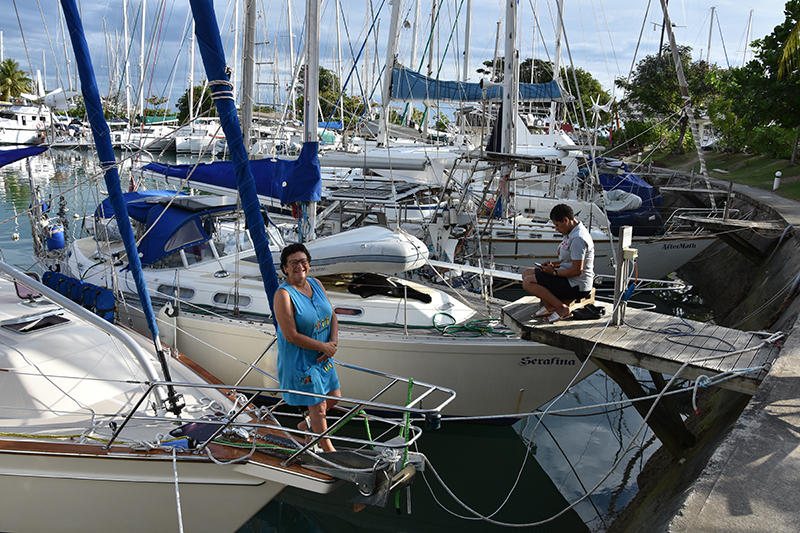
Jan on Morpheus, Vuda marina
Much as I try and mostly avoid marinas it is good once in the while, pretty easy shore access, unlimited fresh water, showers ashore and of course a bar and restaurant. It is relaxing and was good to catch up with friends, not have to cook for a few meals and listen to some live music.
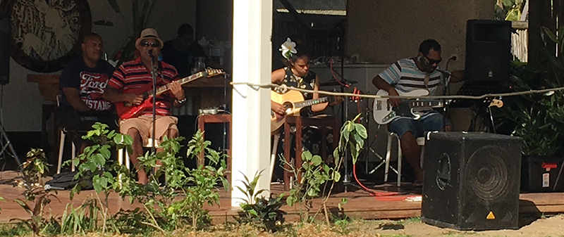
Sunday afternoon band at Vuda
Monday and from the road junction I caught the bus into into Nadi, Fiji’s 2nd town. Here I visited the Sri Siva Subramaniya temple, built in Dravidian and Vastu Vedic traditions, it is stunningly decorated and painted. I ate a nice lunch in the vegetarian restaurant there. A wander around the town and market completed my visit before catching the bus back.

Sri Siva Subramaniya temple
The rope cutter on the propshaft had been making funny noises for a while and I knew that I would have to dive on it to sort it out but conditions at various anchorages had not been ideal, too windy, choppy seas or filthy water with no visibility. Time to do it, I arranged a canvas bag underneath and after repeated dives dismantled the rope cutter. It was badly worn for some reason so I wont be refitting it. The water wasn’t the cleanest here but at least I could nip for a hot shower as soon as I had done.

Vuda sunset
Whilst here I also took a bus to Lautoka, this is the sugar capital of Fiji. There is a big sugar refining factory here with trucks and little railway carts loaded up with cut sugar cane. It is a very Indian town, busy and bustling.
Sugar cane train from bus
It is time for me to leave Fiji so in a couple of days I will check out and make for Vanuatu.
Passage to Vanuatu, & Aneityum, Anelcauhat 14th – 23rd Aug
Before leaving Vuda the staff gathered on the dock and sang me a farewell song.

Farewell to Fiji song
It was about 20 miles to Navula passage, out through the reef. By the time I got there it was growing dark, the wind had picked up and was blowing hard I knew it would be rough outside and the smoke from a fire on the hillside was obscuring the leading lights. I didn’t feel like passing through the reef in those conditions, so although you are not supposed to I turned into Momi bay and anchored there for the night. Much refreshed next morning I set out again, the wind had dropped and I had an easy passage out through the reef and could set course for Vanuatu, 450 miles away. I was aiming for Aneityum, the most southerly of the islands. It is not an official port of entry but you can ask for special permission to clear there, which I had done and it had been granted. The great advantage of clearing here first is that you can then work you way north up the island chain without having to beat against the trade winds. The passage went quite well although the 2nd day turned out very windy with rough and at times very rough seas coming from abeam and breaking. Several times waves broke against the boat and into the cockpit. I managed to stay dry in the shelter of the spray hood. We had a full moon for this passage so the nights were far from dark even with cloud cover.
The only other boat I saw was on the last eve, I had just spotted the island about 60 miles a way and shortened sail to slow down to preclude a nighttime arrival when I spotted a sail astern. It soon passed me.
Landfall at Aneityum just after sunrise
Sunrise of the 5th day out found me about 4miles off the SE corner of the island, just about perfect timing I thought. As I skirted the Southern coast and rounded the reefs there I noticed several sailboats leaving the bay. Great it was the rally boats leaving meaning an uncrowded anchorage. I am not a fan of these yacht rallies of which there seems to be more and more. It means a great crowd of yachts in anchorages all at once. With the rally boats left there was plenty of space for me to choose a nice anchor spot in about 7m of water. My noon to run runs for this passage were all over 100 miles which was pleasing.
Anelcauhat
After a brew of tea I inflated the dinghy and went ashore. My luck was in, Customs, Immigration and Biosecurity officers were all still here, they are not on the island full time so clearance was painless quick and friendly. A stroll through the village and along the beach completed the day.

Anelcauhat village
Anchorage
Next day I walked along tracks and beaches to the next bay and village, all very delightful.
No real roads on the island, people live in simple woven huts by fishing and farming. They speak a form of pigdeon English though many speak English too. They are mostly a little shy but friendly and welcoming always with a greeting.
I walked up to this waterfall in the forest.

Sammy
Sammy who I’d met on 1st day took me a village inland from Anelcauhat and introduced me to Ali who guided me there. I wouldn’t have found the way by myself. A vague trail, muddy in places, over fallen trees, under fallen trees, crossing gulleys and across the river on slippery boulders 5 or 6 times and after 2 or more hard hours we got there.

Waterfall

at the waterfall
Ali’s house

One of the river crossings
Track through forest
Had a refreshing cold swim in the pool under the falls. I had taken some nuts with me and offered some to Ali. From his quizzical expression studying a cashew nut I could tell he had never seen one before, but he enjoyed them. Having left at 10 I was back on the beach and my dinghy about 4 just a little tired.
The bay is open to the West so one morning when the waves started into the bay and a gentle at first west wind, it was time to move out. Francoise the Frenchman in the other boat at anchor came across with some query about english words in descriptions of other anchorages on the island. We decided to head up to Anawamet bay on the North coast, this should give some shelter from the west. It would also be a handy spot for jumping off heading north
Anchoring here, the village chief paddled out in his dugout canoe to say hi and welcome us and I had quite a long chat with him about his village and the island.
Tana 24th- 28th Aug
Leaving Anawamet bay just after sunrise I was headed for the island of Tana. Calm at first the wind and waves soon picked up and we had 2 mad half hour periods when the wind went from about 15 to over 25 knots and more very quickly raising quite a sea. Fortunately later it eased a little later but the sea state remained rough all day. Rounding point Yewao, the wind was up to 25 knots again but we could head into Port Resolution where although the wind remained strong the seas flattened out and I could anchor in about 6 m. There were about 6 other boats anchored here, the main attraction here being Mt Yasur, an active volcano. Port Resolution was named by that man Captain Cook again, seems like I have been following in his wake for a couple of years now.
Port Resolution
I visited the village ashore and was given a welcoming gift couple of bunches of bananas and a big pawpaw by Johnson.
Port Resolution village
I arranged a trip to visit the volcano through him. In the afternoon we were driven in a 4wheel drive pickup to the reception centre at the the foot of the mountain.
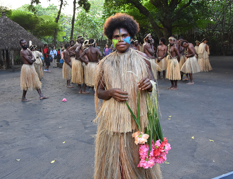
Presentation of flowers

Volcano dance
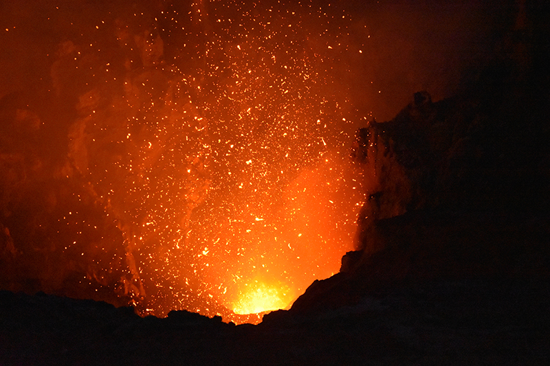
After a ceremonial presentation and a “volcano” dance by the villagers we drove up the 4wheel drive track to a grey ashy plain. A walk up to the crater rim in the late afternoon and we could peer down into what looked like the pit of hell.

To the crater rim

The crater
Further around the rim the bubbling lava was plain to see and every now and then and explosion would send molten fragments high to splash on the crater walls. As darkness fell the sight was even more spectacular. It was an awe inspiring experience to be so close.


Another day I walked around the bay and up steep forest tracks to Enpitoka jungle farm. Philimon the chief wasn’t there but his wife showed me around the gardens and showed me some of the crops they grew which included: yams, taro, manioc, tobacco, onions, cabbage (but not the stuff we know, this was leaves of a small tree), kava, lemons, bananas and coconuts. She also gave me some slices of pawpaw to eat.

Enpitoka forest farm
On the way back I stopped for a chat with a young man in one of the small settlements in the forest and he explained how the villagers acted collectively.
Much as I enjoyed staying in Port Resolution the anchorage was a little rolly and there were so many more islands to explore so I decided to move onto Eromanga the next island in the chain.
Erromango & Efate 29th Aug – 8th Sept
The next hop was 50 miles to Dillon bay on Erromango island. I wasn’t sure whether I would be able to do this in daylight hours, there is just 12 hours of daylight here. I weighed anchor just before sunrise and had a nice view of Mt Yasur the volcano “pothering” out its smoke.

Mt Yasur, Tana
The forecast had been for 10-15 knots from SE but it was stronger than that so I was able to keep up a good speed and 11 hours later I had dropped anchor in Dillon Bay. I was very pleased with that.
Dillon bay
David from the village paddled out in his outrigger dugout canoe with a gift of bananas, pawpaw and the biggest lemon I had ever seen. I gave him some flour and rice, the supply boat only visits once a month so they run low of things at times
He has built a “yacht cub” ashore for visiting cruisers. Next day I visited him there, he has set himself up as a guide. He showed me the village, the gardens and a delightful swimming pool in the river where I had a lovely dip. He told me the names of the trees and their uses some as a source of incense (sandlewood) others to use as lamps, and which trees they made their dug out canoes from. I was surprised to learn that there are Kauri trees here and they have created a protected zone for them. Afterwards I had lunch with them, rice , yams, fried bananas, manioc, a stew/soup of beef and cabbage fresh squeezed lemon juice and of course pawpaw. Again I learned a little more off the island. Although it is quite a big island there are just 2 villages and there is virtually no development on the island and it is largely off the tourist track.
the River at Dillon bay
Some strong winds arrived so I stayed put for a couple of days as the forecasts were for 20-25 knots and very rough seas and I didn’t fancy getting beat about.

Supply ship at the beach
It was 80 miles to Efate, the next island and the capital Port Villa, so it was to be a night time passage. Setting off late afternoon once the weather had eased I was hoping for a quiet and peaceful passage, trouble was the wind had eased so much there was virtually none. I had to resort to motoring, at least the seas were calm, shame about 12 hours of engine noise though. Still arrived in Port Villa and was soon secured to a substantial mooring ball.
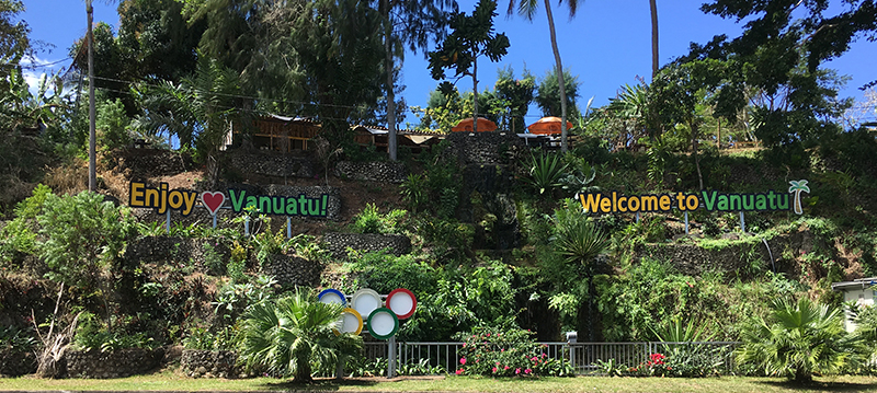
Port Villa welcome
Ashore it was a bit of a culture shock, shops, banks, restaurants, busy with traffic, all the trappings of a tourist town and the place seemed overrun with Aussies. Well I suppose it’s just a fairly short hop for them, a bit like Brits jetting off to Spain or Greece for their holidays. Still it was good to replenish the stores on things that I had run out of or was running short off. There was a strong French influence about the place, some french supermarkets and the bread was baguette style.

Distant view of mooring field Port Villa
With such a sheltered & calm mooring field here I thought it ideal to clean off the bottom of Sea Bear after all she had been in the water for 6 months now. I was lying in the dinghy, arm in the water scrubbing the waterline when the moorings boatman spotted me and made me an offer I couldn’t refuse to clean the hull for me for a very cheap price. So now we have a nice clean hull again, it makes quite a difference to the sailing performance.
No Results Found
The page you requested could not be found. Try refining your search, or use the navigation above to locate the post.